

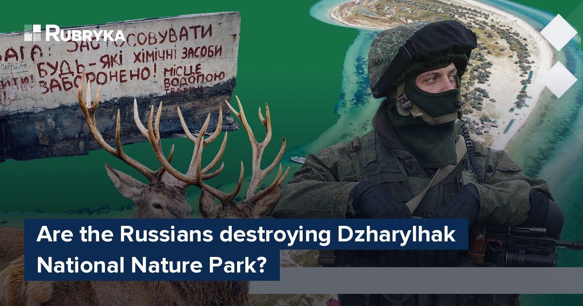
Are the Russians destroying Dzharylhak National Nature Park?


What is the problem?
Dzharylhach Island is the largest Ukrainian island in the Black Sea. The entire territory of the island and part of the water area has a special protection status of a National Park.
Dzharylhach Island, together with the western part of Tendra Bay, is the most significant migratory waterfowl station in Europe, a nesting and wintering place for wild migratory birds that gather from the entire area from the Black Sea to the Arctic Ocean. In addition, valuable wetlands and endemic plants of the park's territory are listed in the Red Book. These are two types of plants: Kenter Rusanova and Black Sea Molinia. They can only be found on the island territory. All this is now in danger.
👉 In 2023, the occupiers registered the Dzharylhak National Nature Park, which was occupied in 2022, in the Kherson region, according to Russian legislation.
According to Iryna Sabashenko, the Ukrainian director of the Dzharylhak National Nature Park, the institution was re-registered to allow the shooting of animals on the park's territory. The director of the national park claims that the main activity of the institution under the occupation administration will be hunting, capturing, and shooting animals.
"These actions are absolutely illegal, illegitimate, criminal. The Law of Ukraine On the Nature Reserve Fund of Ukraine clearly defines the ban on hunting in such objects of the nature reserve fund," says Sabashenko
👉 Recently, the General Staff of the Armed Forces of Ukraine reported that the Russians had created a man-made spit that connects Dzharylhach Island with the mainland. The message says that the Russians covered the crossing to the island with sand in the area of the village of Lazurne. The General Staff also explains that the occupiers did this to more actively use the Ukrainian reserve for military purposes and set up an army training ground on the island.
But is it possible to create an artificial spit that will turn the island into a peninsula? Satellite images from previous years indicate that the chasm appeared and disappeared again in different years, long before occupying Russian troops in the Kherson region appeared. Rubryka turned to specialists to find out what was wrong with Dzharylhach.
What is the solution?
Whether Dzharylhach is an island or not depends entirely on the Lazurnenska chasm, a section of the sand spit that leads to Dzharylhach that appears from time to time.
This chasm is considered a natural object which has a natural genesis. It arises due to the rush of water during the winds of the eastern and north-eastern direction to the corner of the Dzharylhach Bay. Under these conditions, the level rises, and the pressure of the water column is exerted on the rear bank of the Dzharylhach spit, resulting in a breakthrough. This process is not constant; it naturally tends to close and shift in different seasons (for example, shallowing in the hot season and vice versa after the cold season, it can reach the largest sizes). This is a natural process but not cyclical, explains Sabashenko.
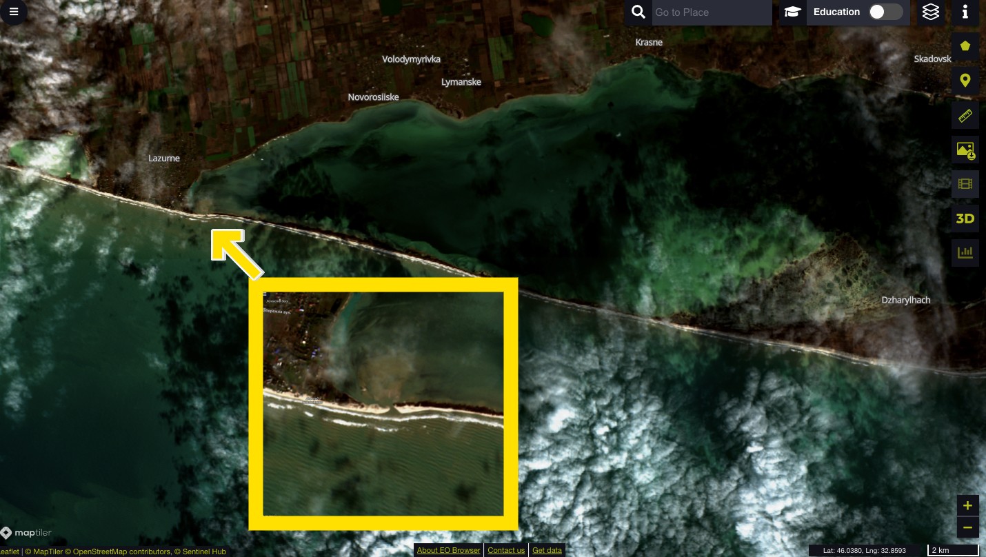
Satellite image of the Dzharylhach spit, taken in January 2022. The enlarged area where the Lazurnenska rill is located is highlighted in yellow. Rubryka's infographic
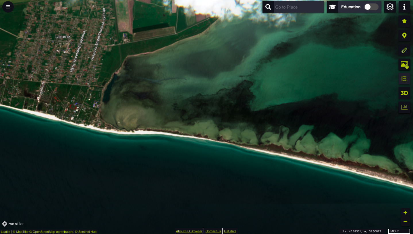
Satellite image of the area where the chasm was as of May 14, 2023. The rill is no longer visualized.
Why, this time, the appearance of spit is associated with the intervention of Russians in natural processes?
"At the end of March 2023, we found out that in the area of the village of Lazurne, the rill was blocked by laying pipes, with the aim of unimpeded passage to the insular part of the island by motor vehicle," says Sabashenko.
It was confirmed after the director of the national park turned to one of the friendly national parks for help in the preparation of the scientific justification, namely space cameras, which allowed following the dynamics of the life of the natural object.
According to the conclusions of the analysis, during the war period until May 24, 2022, the coastline dynamics corresponded to the pre-war dynamics. Since June 3, 2022, a sandbank has been identified from the Black Sea side, which has been stable and uninterrupted during monitoring until now. This indicates its artificial origin with measures to delay coastal sediments. Even though the disappearance of the ravine may well be a natural phenomenon caused by a rose of winds and sand mining by water, this time, the phenomenon is considered man-made.
Is there military equipment on the island, and why do the Russians need the spit?
Ecologist Oleksii Rehel from the UWEC NGO, which studies the effects of the war on Ukraine's environment, says that the Russians may do the sand washing to be able to ferry military equipment to Dzharylgach.
Referring to the words of residents, Ivan Musienko, a member of the NGO Ukrainian Nature Protection Group, in a comment to the Nova Kakhovka City media outlet, noted that residents report constant explosions on the island and the rumble of machinery. He also noted that the presence of equipment on the island is hazardous for the Dzharylhach ecosystem, as it is very unstable to anthropogenic influence.
At the same time, the National Park authorities do not confirm the presence of military equipment on Dzharylhach.
"I cannot comment regarding military equipment on Dzharylhach. I don't have official information," Sabashenko told Rubryka.
What should be done?
Such treatment of a natural object and interference in biological processes is unacceptable from the point of view of environmental legislation. Dzharylhach Bay and the island are included in the list of the most important wetlands of international importance according to the Ramsar Convention.
"I, as the head of the Dzharylhak National Nature Park, am trying to spread this information as much as possible to publicize the unacceptable actions of criminals. Corresponding appeals have been sent to the Ministry of the Environment," comments Sabashenko.
The director of the National Park sent the materials of the analysis of the data of remote sensing of the Earth (Sentinel 2A, 2B satellites) to the Ministry of Environmental Protection and law enforcement agencies — to record the Russian Federation's war crime. The data were collected from March 2017 to April 2023 within the strait connecting Dzharylhach Bay and the Black Sea in the Lazurne region.
Ukraine's environmental ministry prepared and sent a formal notification to the Secretariat of the Ramsar and Bonn Conventions in early April 2023. The ministry asks the Secretariat to take appropriate measures to respond to the situation and create a response mechanism for similar situations in the future. The ministry's main goal now is to curb Russia's purposeful and systematic destruction of the environment and natural ecosystems in Ukraine.


Newsletter
Digest of the most interesting news: just about the main thing