Solutions to win: drones to be used for mines detection in Kyiv region
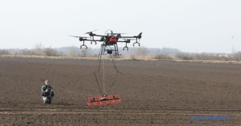
Photo:Ukrinform
The Polish charitable foundation Fundacja POSTUP has been testing new technology for detecting mines and explosives using unmanned aerial vehicles (UAVs)in the district of Bila Tserva, the Kyiv region.
Ukrinform reports this.
What is the problem?
Due to russian aggression, Ukraine is now one of the most heavily contaminated countries by landmines and unexploded ordnance in the world. Estimates suggest that in nine Ukrainian regions (Dnipropetrovsk, Zaporizhzhya, Kyiv, Mykolaiv, Sumy, Kharkiv, Kherson, Chernihiv, and Cherkasy), over 470,854 hectares of agricultural land require surveying and, where necessary, demining.
russia has created the world's largest minefield in Ukraine. Its area reaches 250 thousand square kilometers. Kyiv region is one of the most mined regions of the country.
What is the solution?
Humanitarian demining is the first stage of the restoration of the de-occupied territories, said Denys Shmyhal, the head of the government.
The Polish charitable foundation "Fundacja POSTUP" tested new technology for identifying mines and explosive objects using unmanned aerial vehicles.
Representatives of the pyrotechnic and explosive units of the State Emergency Service and the police said that the new technology would significantly speed up the examination of territories and help save the lives of both their personnel and civilians.
How does it work?
POSTUP representatives demonstrated how the mine identification system works in the conditions of the test site.
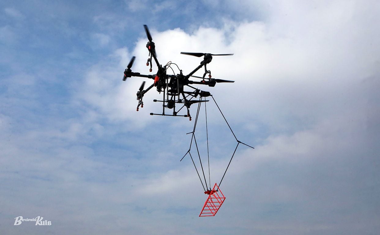
"This system for scanning mines and explosive objects is called a magnetometer, which is used together with a commercial drone for spraying fields – Agras T16. And our foundation additionally developed an attachement – a structure that is fastened to the drone.
That is, on the basis of this system, we scan a certain field, process the data and get a map of the minefield, which sappers can further use in their work," Vlad Kozak, the founder, and director of the POSTUP foundation, said during the presentation of the elements of this technology.
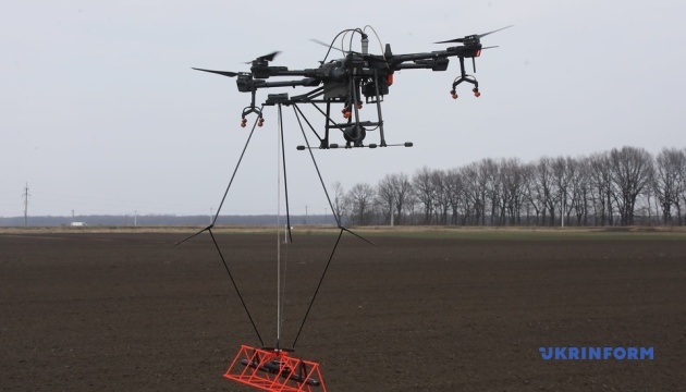 Photo: Ukrinform
When the drone takes off, the magnetometer drops to a distance of approximately two meters from the drone. Due to this, the magnetic background from the drone is reduced because its design has many metal elements.
It also allows keeping the minimum distance from the magnetometer to the field. That is, the drone itself flies at the height of three meters from the ground, and the magnetometer is at a distance of 0.3-0.7 meters.
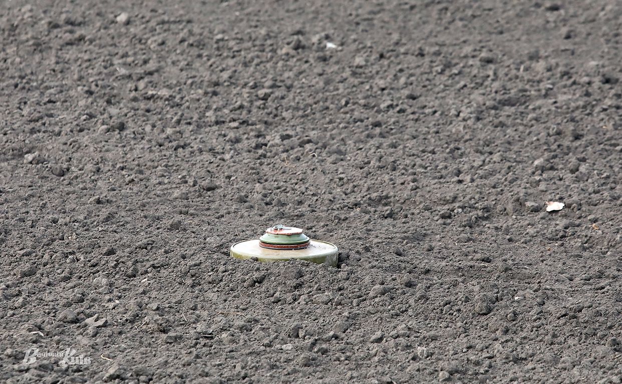
Data is written not only from the magnetometer but also from the drone. So the information from these two devices is transferred to the computer and processed — including to avoid measurement error, which can be up to two meters. The resulting data is then superimposed on a map that can be visualized.
The charitable foundation uses a German-made magnetometer for measurements, American geophysics software, and commercial DJI Agras drones.


