Ukraine will record environmental violations with aerospace photography
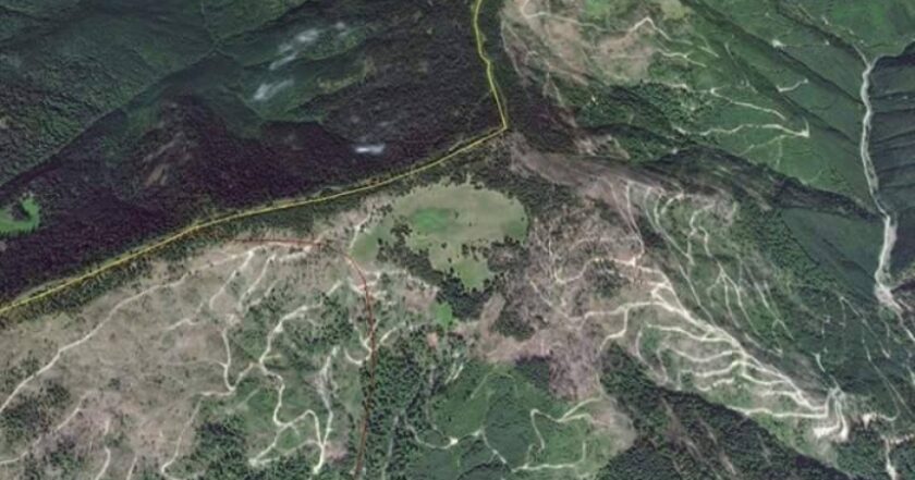
The State Environmental Inspectorate will monitor illegal deforestation and quarry development through an aerial and satellite survey.
According to the press service of the department, they expect that it'll also be able to record the transport of violators.
"The State Environmental Inspectorate will monitor environmental offenses through aerospace photography," the statement said.
In cooperation with the State Ecological Academy of Postgraduate Education and Management, the inspectorate will receive geo-referenced data of the Earth, provided to the school by the National Space Facilities Control And Test Center.
With the help of aerospace images, the State Environmental Inspectorate will detect illegal quarrying, mass deforestation, and other environmental violations; monitor the transport which violators used; assess the overall environmental situation in retrospect, comparing images of different periods; conduct an inventory and assessment of land quality.
"It will allow the State Environmental Inspectorate to record crimes against the environment more accurately and find the culprits faster. A retrospective analysis will help to understand which areas need to be strengthened," the statement said.
The press service added that the monitoring project is being launched in a pilot mode. However, over time, they plan to launch such aerospace monitoring permanently.


